Showing posts with label North Dakota. Show all posts

Monday, May 14, 2012

Wild Turkeys

I forgot about the Wild Turkeys (Meleagris gallopavo) I saw in North Dakota a couple weeks ago.  I didn't get stopped and camera grabbed soon enough to get a photo of a male all puffed out in the ole Thanksgiving Turkey display.  Too bad, he was gorgeous.

I heard him gobble, though.


A cool fact from AllAboutBirds:

A native of North America, the turkey is one of only two domesticated birds originating in the New World. The Muscovy Duck is the other.

I'm hungry (just kidding....but who doesn't love a good roast turkey dinner?)

Go here to listen to gobbles:


Friday, December 9, 2011

Garrison Dam, North Dakota

Garrison Dam is the second (of six) and largest dam on the Missouri River.  Lake Sakakawea is the result.  This lake is the third largest man-made lake in the United States.   

The writing at the lower left corner of this map informs us that the lake is 178 miles long, is 14 miles wide at its widest point, contains 368,000 surface acres of water.   


The dam location is between points 3 and 5 on the map below.


So, this is the dam.  It is 2.5 miles long; 210 ft high; and, is the fifth largest earthen dam in the world.  It was built between 1946 and 1955 by the US Army Corps of Engineers.


There is a road going down below the dam where several things are going on


Namely, fishing.  The fishing area below the power generating station was a fairly popular place the day I visited.  I followed this nifty rig down


I might even be able to endure a day of fishing in a boat, if it were a rig like this.


This is the fishing lake from the over-flow parking - I suppose it stays somewhat ice-free all winter


An eagle's nest - several juvenile Bald Eagles were cruising the area.


A small channel which is likely a pretty spot in Spring and Summer with leafy green trees (yes, I'm missing them already)


The Garrison hydroelectric generating station.  I'll take a tour of the place next time.  There are five turbines. 


The fish hatchery below the dam.   Wikipedia says:  The Garrison Dam National Fish Hatchery is the world's largest walleye and northern pike producing facility.  It also works to restore endangered species (Wiki link below)


A general view to the south from on top of the dam


Another look back at the generating station - those big tanks hold water; a sort of surge moderating affair to keep the flow of water through the turbines at a steady rate. 


The spillway - I didn't stop to take a photo of the concrete side.  A couple of fellows were out there doing repairs.  The spillway was opened for the first time this past June when the lake rose above its maximum volume.  Communities were flooded (it was a hard year for many who live along our northern prairie rivers).

My Inner Rock Hound dearly wants to know where all this pink quartzite came from!


Riverdale, the community at the East end of the dam.  A town formed around the housing built for the Engineers.


The building of the dam and creation of Lake Sakakwea has brought a good deal of recreation to this area of North Dakota.  Unfortunately, there's a down side.  Several communities in the Fort Berthold Indian Reservation were flooded.  People were displaced and New Town built.  The promise of irrigation for the remaining farm land on the reservation (and elsewhere along the lake) never happened.  The 4 Bears Casino may be taking some revenge...

Note, anyone reading this and considering visiting the region, be aware there is a frenetic oil boom going on throughout the NW part of the state, generally north of Lake Sakakawea.  There will be zero drop-in hotel rooms available in Williston, so have the room reservations made in advance.

There are several campgrounds.  One is somewhere near the above photo'd fishing area.  Another is Lake Sakakawea State Park at the west end of the dam (oh yes, there is a dam bar, in fact the best dam bar, by a damsite - what dam site would be complete without one!)

Some info links - the first one is really good for fishing info

Tuesday, November 29, 2011

Lake Audubon, North Dakota

Last week I packed up my little cat Freddie and went across the border to North Dakota (just a few miles away).  Destination:  the state capitol, Bismarck.

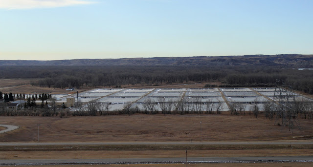
We went down via ND #5 and I-83.  A bit south of Minot, I-83 crosses the eastern end of the great reservoir created by the Garrison Dam.  The west side of the bridge is Lake Sakakawea.  The east side is Lake Audubon and the Lake Audubon Wildlife Refuge.

There is a new visitor's center.  What a fantastic place.


This sign made me smile.  My Tribute is not terribly fuel efficient, although not bad for a small SUV, so I didn't park there.


This National Wildlife Refuge, like all the others, relies on a vast network of dedicated volunteers for building, maintaining, recreating destroyed habitats, etc and what a wonderful thing to be doing with one's time!


The displays are beautiful.


Any place that has a Rachel Carson quote in a prominent place automatically garners my highest respect. 


The Center is all about education. 


Really, one cannot walk around this place and not learn something.


I learned that Redhead ducks sometimes lay an egg in the nest of Canvasbacks, the little sneaks.  I didn't know this sort of thing happened in the world of waterfowl.  Redheads and Canvasbacks are similarly coloured (red head, grey-white-ish body). 


John James Audubon spent a summer in this area, about 1843 or so.


Remarkably creative displays


A prairie profile:  grasses and a purple coneflower (Echinacea sp.) etc at the surface, root system, earthworms, Richardson's ground squirrel tunnels...


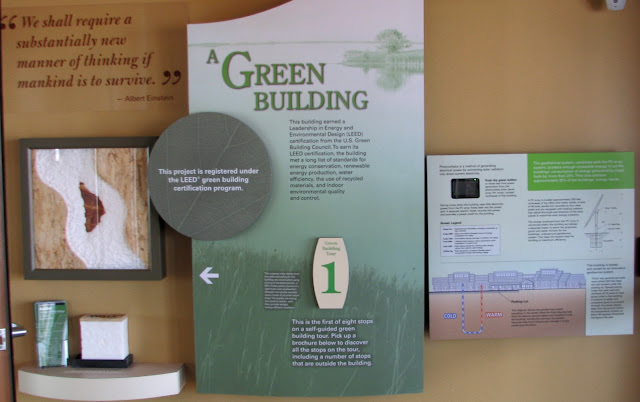
Oh, and this place was built Green and Sustainable.   Geothermal heating/cooling


An array of solar panels


And one of my favourite quotes ever.


Visit the website:  http://www.fws.gov/audubon/

Tuesday, May 3, 2011

Divide County, North Dakota

Divide County is the most NW county in the state of North Dakota.  It is directly south of where I live.  So Divide and the adjacent counties experienced the same nasty storm we had on April 30.   [Since Blogger no longer posts hi-def photos, you have to click on the pix to enlarge and see anything clearly!]


Unfortunately, some 360 power poles went down.  So no electricity, and very cold.   Power was restored to Crosby area by Sunday night.  The grocery store was busy with people - mostly talking about The Storm...


Crosby is the Divide County Seat.  I've been going to this little town my entire life - well, except for those 30+ years I lived elsewhere in Canada and far away from dear old Divide County hugging the International Border. 

The main drag yesterday about noon.


The Courthouse


A peaceful, but snowy street


As of yesterday, the city of Williston, 50-60 miles south and west was still without power.  Some 30,000 people.  It's one of those unfortunate wake-up calls about how reliant we all are on electricity.


Monday, December 13, 2010

North Dakota, Part III

As I mentioned, my route through the state was plotted to visit as many of the National Wildlife Reserves as possible.  There are 63, some of which are simply fields of ground cover or sloughs.   I think I probably hit about 7 of the major areas this trip. 

Here's a White-tailed Deer fawn taken at Arrowwood NWR, near Jamestown


Thirteen-lined Ground Squirrel (Ictidomys tridecemlineatus) with whom I shared a granola bar and a bag of trail mix, at a regional park campground outside of Jamestown.  It and I were the only ones there. 


A 'prairie pothole' near Cayuga; the Tewaukon NWR is just down the road


A young Red-tailed Hawk with very shiny black legs and feet.  


But, it wasn't all birding and tromping around wildlife areas.  Occasionally I stopped into towns - especially ones I remember hearing on the US radio and television stations while I was growing up.  Local stations, with their locally-made advertisements.  The only one I didn't get to was Beluha, make that Beulah (I guess spell checker doesn't know all the names of little towns and neither do I) as there was road-resurfacing from every possible direction.

I stopped into a small place called Hankinson.  I needed groceries.  This is the building across the street from the food mart.


I love small towns 

I also stopped at Rugby, which is not exactly the geographic center of the continent.  I looked up the town on-line last night.  Apparently, they are no longer flying the Mexican flag.  Is that due to current anti-Mexican sentiment, or a sudden realization that the real center of the continent, which does include Mexico and Central America is likely somewhere in South Dakota or whatever state is south of that, I don't know.  Here's what the monument looked like when I visited. 


I liked the three flags flying.

End of Trip - or at least end of my trip photos

Sunday, December 12, 2010

North Dakota, Part II

All right, still over on the western side of NoDak, next up is Theodore Roosevelt National Park, South Unit.  Medora is the resort hub of the park.  It's got a western, cowboy theme going on.  There's a big country musical there every year - not my sort of thing, so I've never been to it.

The badlands are quite spectacular.  Also extremely hot in mid-July.  It was sweltering the day I took this photo of a huge bull bison.


A Black-tailed Prairie Dog  (Cynomys ludovicianus)


Did I say it was hot that day


On to the Cross Ranch by the Missouri River, some 30 miles north of Mandan. 


The Nature Conservancy has secured a portion of the ranch along the western side of the river, plus there's a state park.  Nice quiet place to stay.  Good fishing I think.  Spotted Towhees and Lazuli Buntings had nests in the shrubs around my isolated campsite.  Field Sparrows sang all day long.


This is on the Lewis & Clark Trail (click on photo to enlarge).


There's interesting information about TRNP at these links: 
http://www.nps.gov/thro/index.htm
http://www.realnd.com/badlandsindex.htm
The geology of the park:
http://theodoreroosevelt.areaparks.com/parkinfo.html?pid=26955
About the Lewis & Clark Expedition
http://www.nationalgeographic.com/lewisandclark/
http://en.wikipedia.org/wiki/Lewis_and_Clark_Expedition

Saturday, December 11, 2010

North Dakota, Part I

Yesterday I dreamed up the idea I should go to Minot, ND today.  Minot is approximately 150 kms or 90 miles away to the SE of my location.  However, when the morning dawned and I became aware that the outside temperature was hovering at -23C with a windchill making things feel like -32C, it hit me there really isn't anything anywhere that I needed to see, do or buy.  At least not today, a chilly Saturday before Christmas.  What WAS I thinking?

Like Saskatchewan, North Dakota is one of those places most people just drive through in order to get somewhere else.  I realized I hadn't seen much of it myself, so in July 2008, I toddled off in my RV to visit as many NWRs as I could in 10 days.

These photos were taken along Hwy #22 south through the Fort Berthold Indian Rez down to Killdeer.  This is a designated scenic route (and it is a lovely stretch of road); also part of the Lewis & Clark trail too, I think.       


Scrub prairie, east of the North Unit of Theodore Roosevelt Nat'l Park


Some wild horses on a hill


This could be Cherry Creek - or something else


It's a land created by erosion into buttes, gullies and plains.


More to come.   (click on photos to enlarge, if you want to)