Garrison Dam is the second (of six) and largest dam on the Missouri River. Lake Sakakawea is the result. This lake is the third largest man-made lake in the United States.
The writing at the lower left corner of this map informs us that the lake is 178 miles long, is 14 miles wide at its widest point, contains 368,000 surface acres of water.

The dam location is between points 3 and 5 on the map below.

So, this is the dam. It is 2.5 miles long; 210 ft high; and, is the fifth largest earthen dam in the world. It was built between 1946 and 1955 by the US Army Corps of Engineers.

There is a road going down below the dam where several things are going on

Namely, fishing. The fishing area below the power generating station was a fairly popular place the day I visited. I followed this nifty rig down

I might even be able to endure a day of fishing in a boat, if it were a rig like this.

This is the fishing lake from the over-flow parking - I suppose it stays somewhat ice-free all winter

An eagle's nest - several juvenile Bald Eagles were cruising the area.

A small channel which is likely a pretty spot in Spring and Summer with leafy green trees (yes, I'm missing them already)

The Garrison hydroelectric generating station. I'll take a tour of the place next time. There are five turbines.

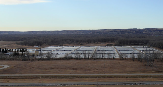
The fish hatchery below the dam. Wikipedia says: The Garrison Dam National Fish Hatchery is the world's largest walleye and northern pike producing facility. It also works to restore endangered species (Wiki link below)
A general view to the south from on top of the dam

Another look back at the generating station - those big tanks hold water; a sort of surge moderating affair to keep the flow of water through the turbines at a steady rate.


The spillway - I didn't stop to take a photo of the concrete side. A couple of fellows were out there doing repairs. The spillway was opened for the first time this past June when the lake rose above its maximum volume. Communities were flooded (it was a hard year for many who live along our northern prairie rivers).
My Inner Rock Hound dearly wants to know where all this pink quartzite came from!

Riverdale, the community at the East end of the dam. A town formed around the housing built for the Engineers.

The building of the dam and creation of Lake Sakakwea has brought a good deal of recreation to this area of North Dakota. Unfortunately, there's a down side. Several communities in the Fort Berthold Indian Reservation were flooded. People were displaced and New Town built. The promise of irrigation for the remaining farm land on the reservation (and elsewhere along the lake) never happened. The 4 Bears Casino may be taking some revenge...
Note, anyone reading this and considering visiting the region, be aware there is a frenetic oil boom going on throughout the NW part of the state, generally north of Lake Sakakawea. There will be zero drop-in hotel rooms available in Williston, so have the room reservations made in advance.
There are several campgrounds. One is somewhere near the above photo'd fishing area. Another is Lake Sakakawea State Park at the west end of the dam (oh yes, there is a dam bar, in fact the best dam bar, by a damsite - what dam site would be complete without one!)
Some info links - the first one is really good for fishing info
The writing at the lower left corner of this map informs us that the lake is 178 miles long, is 14 miles wide at its widest point, contains 368,000 surface acres of water.

The dam location is between points 3 and 5 on the map below.

So, this is the dam. It is 2.5 miles long; 210 ft high; and, is the fifth largest earthen dam in the world. It was built between 1946 and 1955 by the US Army Corps of Engineers.

There is a road going down below the dam where several things are going on

Namely, fishing. The fishing area below the power generating station was a fairly popular place the day I visited. I followed this nifty rig down

I might even be able to endure a day of fishing in a boat, if it were a rig like this.

This is the fishing lake from the over-flow parking - I suppose it stays somewhat ice-free all winter

An eagle's nest - several juvenile Bald Eagles were cruising the area.

A small channel which is likely a pretty spot in Spring and Summer with leafy green trees (yes, I'm missing them already)

The Garrison hydroelectric generating station. I'll take a tour of the place next time. There are five turbines.

The fish hatchery below the dam. Wikipedia says: The Garrison Dam National Fish Hatchery is the world's largest walleye and northern pike producing facility. It also works to restore endangered species (Wiki link below)

A general view to the south from on top of the dam

Another look back at the generating station - those big tanks hold water; a sort of surge moderating affair to keep the flow of water through the turbines at a steady rate.


The spillway - I didn't stop to take a photo of the concrete side. A couple of fellows were out there doing repairs. The spillway was opened for the first time this past June when the lake rose above its maximum volume. Communities were flooded (it was a hard year for many who live along our northern prairie rivers).
My Inner Rock Hound dearly wants to know where all this pink quartzite came from!

Riverdale, the community at the East end of the dam. A town formed around the housing built for the Engineers.

The building of the dam and creation of Lake Sakakwea has brought a good deal of recreation to this area of North Dakota. Unfortunately, there's a down side. Several communities in the Fort Berthold Indian Reservation were flooded. People were displaced and New Town built. The promise of irrigation for the remaining farm land on the reservation (and elsewhere along the lake) never happened. The 4 Bears Casino may be taking some revenge...
Note, anyone reading this and considering visiting the region, be aware there is a frenetic oil boom going on throughout the NW part of the state, generally north of Lake Sakakawea. There will be zero drop-in hotel rooms available in Williston, so have the room reservations made in advance.
There are several campgrounds. One is somewhere near the above photo'd fishing area. Another is Lake Sakakawea State Park at the west end of the dam (oh yes, there is a dam bar, in fact the best dam bar, by a damsite - what dam site would be complete without one!)
Some info links - the first one is really good for fishing info
What an interesting post, Kathy. In my younger days I'd often thought of retracing (by canoe) Lewis and Clarks Missouri river trek. Perhaps now in my next life. My sons in-laws beautiful home was flooded out in Bismarck. Something totally unexpected. We're off to the desert to visit the Grands. Till next time have a joyous Holiday Season... :)
ReplyDeleteThanks, Troutbirder. Have a lovely Christmas season with your family. Travel safely.
ReplyDelete