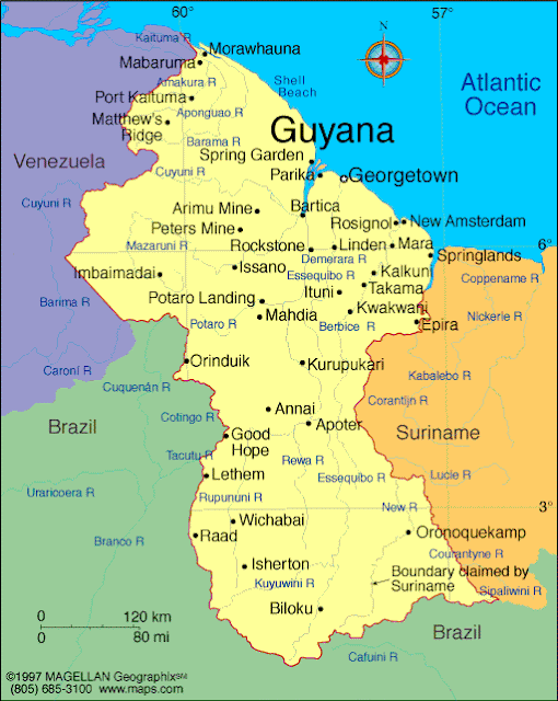
Update: Most of my locations are in the between Mahdia - Kurupakari - Annai - Lethem - Potaro River & Landing. The Iwokrama Forest Reserve is in that area. Karanambu Ranch is north east of Lethem on the Rupunumi River. The rest of our lodges, etc are fairly close together.
For your info: Remember the Jonestown event from the 70s? That was up in the NE corner of the country somewhere
And even wilder than the flag, the national bird is the Hoatzin, which I may not get a chance to see
I'll pull out my uber-detailed map and try to figure out where exactly I'll be and update this post tomorrow - if I connect any dots.


Happy Trails to You Kath, LG
ReplyDeleteThat should be absolutely great. I'm jealous though so take and post lots of pictures. And.....stay away from the Kool Aid. :)
ReplyDelete